Some Projects
-
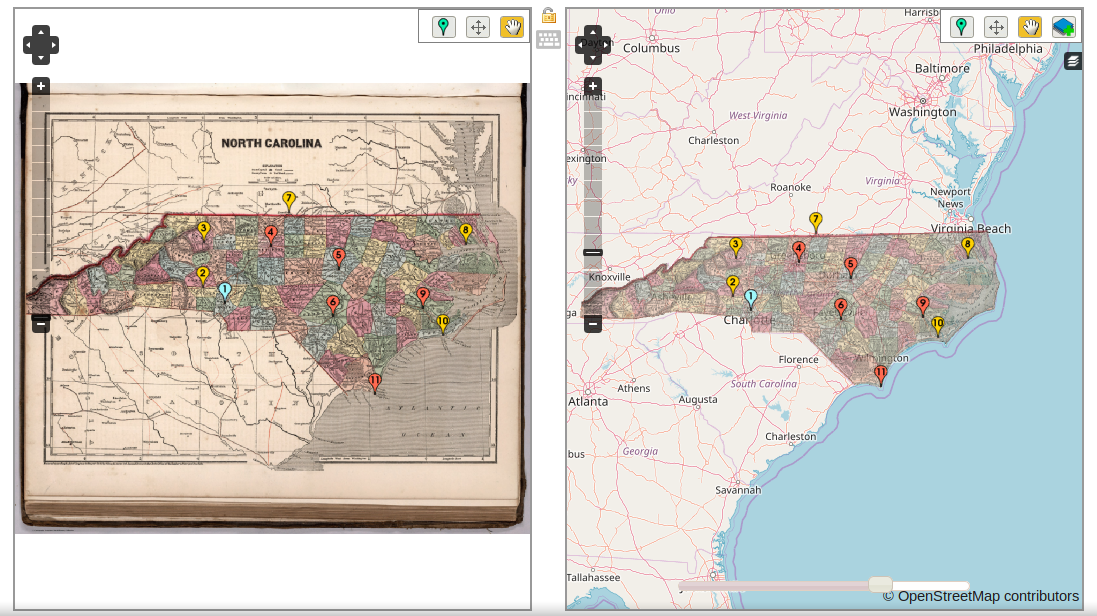 Mapwarper
Mapwarper (available at MapWarper.net) is an open source free crowdsourcing georectification tool to enable people to upload images and maps and georeference or warp them onto a modern map. Maps can be exported to Tiles and WMS and mosaiced together. Instances are in place in Japan, Harvard University, New York Public Library and in the Leiden Archives.
-
 Digital Gazetteer
The Digital Gazetteer is bibliographic remediation tool for the Library of Congress, and a histroical tool for the New York Public Library. Names and locations of places, buildings and landmarks can be conflated and searched, and historical maps can be shown with the features.
-
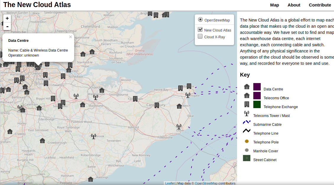 New Cloud Atlas
The New Cloud Atlas is a global effort to map each data place that makes up the cloud in an open and accountable way. The project sets out to find and map each warehouse data centre, each internet exchange,each connecting cable and switch. The project uses the OpenStreetMap pipeline and renders custom cartographically designe tiles.
-
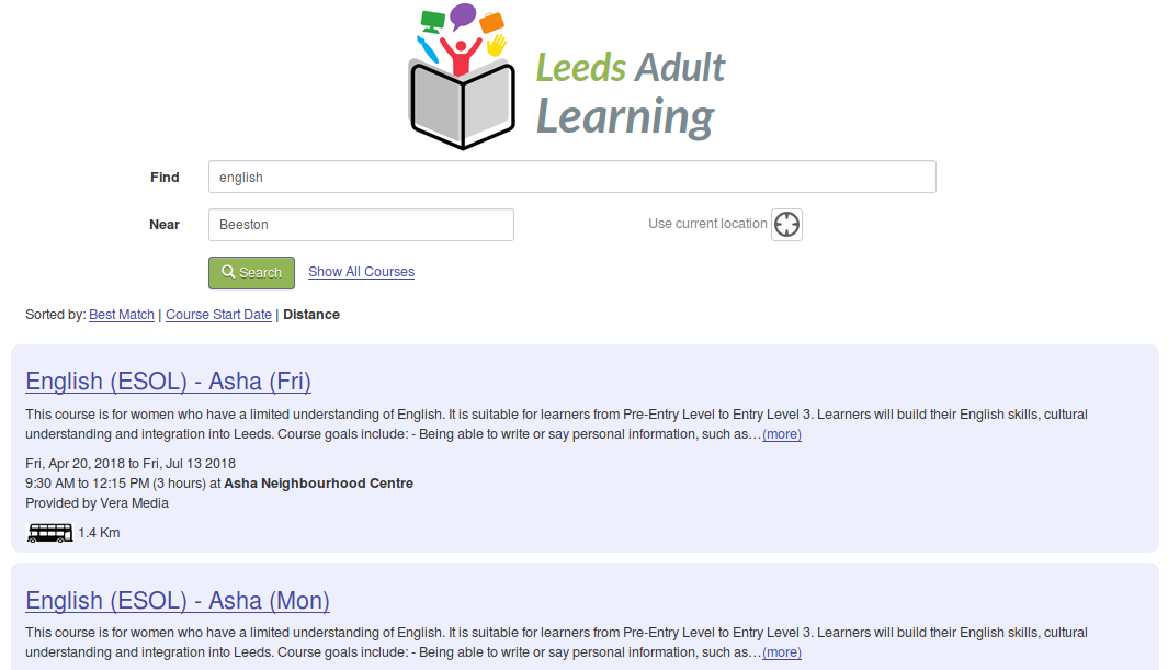 Leeds Adult Learning
Leeds Adult Learning is a course finder for about 300 courses by the City and run by a number of providers and dozens of venues. It offers a range of first step courses for adults, such as basic IT skills, ESOL, caring and crafts. Within the first 24 hours of launch it received over 3000 visits, in the first month, it had over 25,000 visits. It's powered by PostGIS and incorporates walking and transit routing.